© Photo: Oberösterreich Tourismus GmbH./Robert Maybach: Enjoy the view in Upper Austria


ORGANIXWEG | Bewegungs-Arena INNVIERTEL


- Suitable for families
- Suitable for pushchairs
- Flatly
Interactive elevation profile
Create PDF
Tour-Details
Path number: Nr. 3
Starting place: 4925 Pramet
Destination: 4925 Pramet
duration: 1h 19m
length: 5,0 km
Altitude difference (uphill): 57m
Altitude difference (downhill): 62m
Lowest point: 508m
Highest point: 570m
difficulty: easy
condition: easy
panoramic view: Great panorama
Paths covering:
Hiking trail
powered by TOURDATA
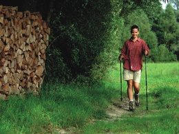
If you only want to hike a short digestive round or start a short run the Organixweg is a wonderful place to start.
- Suitable for groups
- Suitable for schools
- Suitable for pushchairs
- Suitable for teenagers
- Suitable for seniors
- Suitable for single travelers
- Suitable for families
- Suitable for friends
- Suitable for couples
- Suitable for children
- Spring
- Summer
- Autumn
- Early winter
Please get in touch for more information.
4925 Pramet
Phone +43 7754 8450
E-Mail gemeinde@pramet.ooe.gv.at
Web www.pramet.at/system/web/default.as…
https://www.pramet.at/system/web/default.aspx?sprache=1
You can also visit us on
Visit us on Facebook")

Interactive elevation profile
Create PDF
Tour-Details
Path number: Nr. 3
Starting place: 4925 Pramet
Destination: 4925 Pramet
duration: 1h 19m
length: 5,0 km
Altitude difference (uphill): 57m
Altitude difference (downhill): 62m
Lowest point: 508m
Highest point: 570m
difficulty: easy
condition: easy
panoramic view: Great panorama
Paths covering:
Hiking trail
powered by TOURDATA