© Photo: Oberösterreich Tourismus GmbH./Robert Maybach: Enjoy the view in Upper Austria


TIEFENTAL RUNDE | Bewegungs-Arena INNVIERTEL
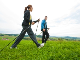


- Suitable for families
- Flatly
Interactive elevation profile
Create PDF
Tour-Details
Starting place: 4923 Lohnsburg am Kobernaußerwald
Destination: 4923 Lohnsburg am Kobernaußerwald
duration: 1h 58m
length: 6,9 km
Altitude difference (uphill): 148m
Altitude difference (downhill): 147m
Lowest point: 557m
Highest point: 674m
difficulty: easy
condition: easy
panoramic view: Some Views
Paths covering:
Hiking trail
powered by TOURDATA
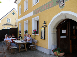
Via Reiching, the route leads over a meadow path in the direction of Stelzen. From there follows a flat, less strenuous route to Schlag. Then it continues on a more demanding route to Warmanstadl and steeply downhill through the forest to Mitterberg. Furthermore, it then goes steeply uphill on the goods road back to Kobernexternal. Possibility to stop at the castle tavern Kobernextern.
Relaxliege
- Suitable for groups
- Suitable for teenagers
- Suitable for single travelers
- Suitable for families
- Suitable for friends
- Suitable for couples
- Spring
- Summer
- Autumn
- Early winter
- Deep winter
Please get in touch for more information.
4923 Lohnsburg am Kobernaußerwald
Phone +43 7754 4110
E-Mail gemeinde@lohnsburg.at
Web lohnsburg.at
https://lohnsburg.at
You can also visit us on
Visit us on FacebookInteractive elevation profile
Create PDF
Tour-Details
Starting place: 4923 Lohnsburg am Kobernaußerwald
Destination: 4923 Lohnsburg am Kobernaußerwald
duration: 1h 58m
length: 6,9 km
Altitude difference (uphill): 148m
Altitude difference (downhill): 147m
Lowest point: 557m
Highest point: 674m
difficulty: easy
condition: easy
panoramic view: Some Views
Paths covering:
Hiking trail
powered by TOURDATA