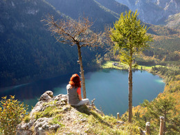
© Photo: Oberösterreich Tourismus GmbH./Robert Maybach: Enjoy the view in Upper Austria


Signalkogel und rund um den Loskogel


Interactive elevation profile
Create PDF
Tour-Details
Starting place: 4802 Ebensee
Destination: 4802 Ebensee
duration: 2h 48m
length: 27,3 km
Altitude difference (uphill): 981m
Altitude difference (downhill): 982m
Lowest point: 429m
Highest point: 946m
difficulty: medium
condition: medium
panoramic view: Individual Views
Paths covering:
Asphalt, Gravel, Other
powered by TOURDATA
roadblock: Pumpspeicherkraftwerk Sonnstein
since 10.05.2024 Mountain bike tour with different variants
opened 15th April till 31st October
Parking
- Parking space: 60
- Parking area for disabled: 2
Most economical season
- Spring
- Summer
- Autumn
Please get in touch for more information.
Hauptstraße 34
4802 Ebensee
Phone +43 6133 8016
E-Mail ebensee@traunsee-almtal.at
Web www.ebensee.com
Web www.traunsee-almtal.at
http://www.ebensee.com
http://www.traunsee-almtal.at
http://www.traunsee-almtal.at
Interactive elevation profile
Create PDF
Tour-Details
Starting place: 4802 Ebensee
Destination: 4802 Ebensee
duration: 2h 48m
length: 27,3 km
Altitude difference (uphill): 981m
Altitude difference (downhill): 982m
Lowest point: 429m
Highest point: 946m
difficulty: medium
condition: medium
panoramic view: Individual Views
Paths covering:
Asphalt, Gravel, Other
powered by TOURDATA