© Photo: Oberösterreich Tourismus GmbH./Robert Maybach: Enjoy the view in Upper Austria


A10 Landschaftsschutzgebiet "Roadlberg"


- pets allowed
- Suitable for kids (all ages)
Interactive elevation profile
Create PDF
Tour-Details
Path number: A10
Starting place: 4211 Alberndorf in der Riedmark
Destination: 4204 Ottenschlag im Mühlkreis
duration: 1h 4m
length: 3,4 km
Altitude difference (uphill): 158m
Altitude difference (downhill): 19m
Lowest point: 588m
Highest point: 746m
difficulty: very easy
condition: easy
panoramic view: Individual Views
Paths covering:
Asphalt, Street, Hiking trail, Other
powered by TOURDATA
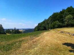
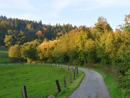
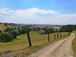
The Roadlberg nature reserve is located in the municipalities of Alberndorf and Ottenschlag and offers hikers beautiful mixed forests, wet forests, flower meadows, marshes and ponds.
At the end or for refreshments before turning back, you can stop off at the "Roadlhof", run by the Keck family, in Wintersdorf (open from Friday to Sunday). Alternatively, the sports buffet at the start/finish at the sports field in Zeurz is also open for refreshments (closed on Mondays).
The A10 hiking trail and the A3 circular hiking trail can be ideally combined to form a circular hike.
Starting point: Alberndorf sports ground in the village of Zeurz
Destination: Wintersdorf, connection to hiking trail A3 possible (circular route)
further information:
- Board possible
Accessibility / arrival
From the centre of Alberndorf drive towards Reichenau, after approx. 1km you will find the sports field on the left-hand side of the road. There is free parking at both the sports field and the Trendsport facility on the opposite side of the road.
Parking- Parking space: 30
- Suitable for groups
- Suitable for kids (all ages)
- Pets allowed
- Suitable for seniors
- Suitable for single travelers
- Suitable for friends
- Suitable for couples
- Suitable for children
- Spring
- Summer
- Autumn
Please get in touch for more information.
4211 Alberndorf in der Riedmark
Phone +43 7235 7155
E-Mail tourismusverband@alberndorf.ooe.gv.at
Web www.alberndorf.at
http://www.alberndorf.at
")
Interactive elevation profile
Create PDF
Tour-Details
Path number: A10
Starting place: 4211 Alberndorf in der Riedmark
Destination: 4204 Ottenschlag im Mühlkreis
duration: 1h 4m
length: 3,4 km
Altitude difference (uphill): 158m
Altitude difference (downhill): 19m
Lowest point: 588m
Highest point: 746m
difficulty: very easy
condition: easy
panoramic view: Individual Views
Paths covering:
Asphalt, Street, Hiking trail, Other
powered by TOURDATA