

To the high cross


- pets allowed
- All weather
- Suitable for families
- Suitable for kids (all ages)
- Flatly
Interactive elevation profile
Create PDF
Tour-Details
Paths covering:
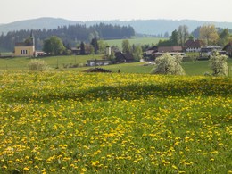
This beautiful hike takes us to the Hohe Kreuz, a wooden cross in the middle of fields and meadows, from where we have a magnificent view of the Totes Gebirge, Traunstein and Höllengebirge mountains.
We walk under the second small railway subway and direct
our steps to a small hill alongside the railway to Schwertfern, where we come across a labyrinth built by young people.
Just before the first building, we turn right through Schwertfern and only branch off to the left again at the end of the village. On the hills of Schwertfern there is a geomantically special place with a strong energy intensity in the meadows. There were probably various ancient places of worship here in the past. The hike continues along the edge of the forest to Rudlberg, where we walk up the small tarmac road past the last farmer, where we reach the highest point and turn left along a meadow path to the Hohe Kreuz.
A beautiful wooden cross stands here in the middle of the fields and meadows, from where we have a wonderful view of the Totes Gebirge, Traunstein, Höllengebirge and Schafberg. After a short rest, we turn left across the meadow until we turn right again along a small tarmac road to Wieneröth.
We can enjoy the view of the Freudenthal valley and continue left along the road to the farming village of Raspoldsedt. We continue to Kühschinken, where a hollow path, whose embankments are covered with colourful meadow flowers in May and early June, leads us down to the railway and Vöckla. This time we cross the Vöckla and, with a bit of luck, we may spot a dipper. The footpath leads us past
remnants of alluvial forest, where the first wild herbs can be found in spring, back to Frankenmarkt.
Car:
From Salzburg via the A1 - exit St. Georgen im Attergau - turn right towards Frankenmarkt
From Vienna/Linz via the A1 - exit St. Georgen im Attergau - turn right towards Frankenmarkt
From the west - Bad Ischl - Weißenbachtal - Unterach - Attersee - St. Georgen im Attergau - continue to Frankenmarkt
Train:
From Salzburg or Linz/Vienna with the "Österreichische Bundesbahnen" or the "Westbahn" to Attnang-Puchheim, continue with the regional train to Frankenmarkt
Plane:
Arrive in Salzburg or Linz/Vienna, continue by car/bus or train.
- Parking space: 5
- All weather
- Suitable for groups
- Suitable for schools
- Suitable for kids (all ages)
- Pets allowed
- Suitable for teenagers
- Suitable for seniors
- Suitable for single travelers
- Suitable for families
- Suitable for friends
- Suitable for couples
- Suitable for children
- Spring
- Summer
- Autumn
- Early winter
Please get in touch for more information.
")
4890 Frankenmarkt
Phone +43 7684 6255 - 13
E-Mail tourismus@frankenmarkt.net
Web tourismus.frankenmarkt.net
Web www.frankenmarkt.at
https://www.frankenmarkt.at
Interactive elevation profile
Create PDF
Tour-Details
Paths covering: