© Photo: Oberösterreich Tourismus GmbH./Robert Maybach: Enjoy the view in Upper Austria


A1 Alberndorf-Aschlberg


Interactive elevation profile
Create PDF
Tour-Details
Starting place: 4211 Alberndorf in der Riedmark
Destination: 4212 Neumarkt im Mühlkreis
duration: 0h 59m
length: 2,8 km
Altitude difference (uphill): 166m
Lowest point: 560m
Highest point: 734m
difficulty: very easy
condition: easy
panoramic view: Some Views
Paths covering:
Asphalt, Path / trail, Street, Hiking trail, Other
powered by TOURDATA
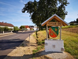
from Alberndorf via Berbersdorf and Hadersdorf to the chapel on the Aschlberg
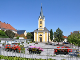
The rest of the hiking route leads past a group of houses and through the forest up to the Aschlberg. After a few minutes you reach your destination, the chapel. A few benches line the place of worship and invite you to linger. Here you can take a short break before returning to Alberndorf along the same route.
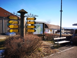
Starting point: Thrift store in the town centre
Destination: Chapel on the Aschlberg
further information:
- Board possible
")
")
")
Accessibility / arrival
How to get there by car:
From Linz, take the A7 motorway to the "Gallneukirchen" exit
Follow the road through Gallneukirchen
After the one-way street, turn diagonally left towards "Alberndorf"
Follow the road for approx. 7 km
The start of the hiking trail is directly in front of the Spar supermarket
There is ample free parking just a few metres away behind the municipal office. After the Spar supermarket, turn left onto Kalchgruberstraße, then turn right.
Travelling by bus:
From Linz via Gallneukirchen (you may need to change buses) to "Alberndorf/Rdm. Ortsmitte"
The bus stop is only a few metres away from the Spar supermarket.
Parking- Parking space: 30
- Parking area for disabled: 2
- Charging point for electric cars (fees apply)
- Charging point for e-bikes (free of charge)
Most economical season
- Spring
- Summer
- Autumn
- Early winter
Please get in touch for more information.
Kalchgruberstraße 2
4211 Alberndorf in der Riedmark
Phone +43 7235 7155
E-Mail tourismusverband@alberndorf.ooe.gv.at
Web www.alberndorf.at
http://www.alberndorf.at
")
Interactive elevation profile
Create PDF
Tour-Details
Starting place: 4211 Alberndorf in der Riedmark
Destination: 4212 Neumarkt im Mühlkreis
duration: 0h 59m
length: 2,8 km
Altitude difference (uphill): 166m
Lowest point: 560m
Highest point: 734m
difficulty: very easy
condition: easy
panoramic view: Some Views
Paths covering:
Asphalt, Path / trail, Street, Hiking trail, Other
powered by TOURDATA