

A3 Rundweg Alberndorf - Wintersdorf


- Flatly
- Possible accommodation
Interactive elevation profile
Create PDF
Tour-Details
Paths covering:
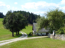
From Alberndorf via Schwarzau to Wintersdorf. Along the way there is a unique dry stone wall with a nature trail. In Wintersdorf, be sure to make a detour to the Roadlberg viewing tower! Via Hirschstein and Zeurz back to Alberndorf (alternative: combination with A10 possible)
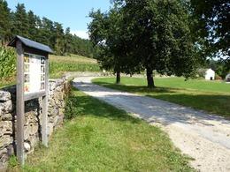
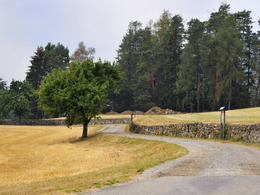
This natural jewel is located in the northernmost corner of the municipal area. Built an unknown time ago, numerous animals and plants have made themselves at home in and around this wall. To save this valuable biotope from decay, it was restored in 2007. Its high ecological value led to the creation of a dry stone wall nature trail in co-operation with the Austrian Nature Conservation Association and the province of Upper Austria.
A short time later, following the path, you reach the village of Wintersdorf (Ottenschlag district) and the Roadlhof farm (open Fridays to Sundays). Here you can take a break and it is particularly exciting for children to marvel at the goats and the game enclosure.
From the Roadlhof, we recommend a short detour to the observation tower on the Roadlberg, from where you have a wonderful view of the Alps.
After Wintersdorf is the highest point of this hike, the route then descends via Hirschstein and Zeurz back to Alberndorf. Alternatively, you can also follow the A10 hiking trail from Roadlhof.
At the start/finish in Zeurz, you can stop off at the Stummer sports buffet.
further information:
- Flatly
- Possible accommodation
- Experience of nature
- Board possible
Details - hiking
- educational path
How to get there by car:
From Linz, take the A7 motorway to the "Gallneukirchen" exit
Follow the road through Gallneukirchen
After the one-way street, turn diagonally left towards "Alberndorf"
Follow the road for approx. 7 km
The start of the hiking trail is directly in front of the Spar supermarket
There is ample free parking just a few metres away behind the municipal office. After the Spar supermarket, turn left onto Kalchgruberstraße, then turn right.
Alternatively, the hiking trail can also be started at the sports field in Zeurz. This shortens the hiking trail by around 1.8 km (there and back). There is also plenty of parking available at the sports field.
Travelling by bus:
From Linz via Gallneukirchen (change may be necessary) to "Alberndorf/Rdm. Ortsmitte"
The bus stop is just a few metres from the Spar supermarket.
Alternatively, the hiking trail can also be started at the sports field in Zeurz. This shortens the hiking trail by around 1.8 km (there & back). The corresponding bus stop "Alberndorf/Rdm. Sportplatz" is, however, less frequently served than the town centre.
- Parking space: 30
- Parking area for disabled: 2
- Charging point for electric cars (fees apply)
- Charging point for e-bikes (free of charge)
- Spring
- Summer
- Autumn
- Early winter
Please get in touch for more information.
4211 Alberndorf in der Riedmark
Phone +43 7235 7155
E-Mail tourismusverband@alberndorf.ooe.gv.at
Web www.alberndorf.at
")
")
Interactive elevation profile
Create PDF
Tour-Details
Paths covering: