

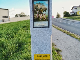
A9 Biblischer Wanderweg


- culturally interesting
- Flatly
Interactive elevation profile
Create PDF
Tour-Details
Paths covering:
Circular trail with many wayside shrines, wayside crosses and wayside shrines, including the Way of the Cross in Heinberg and St Mary's Grotto
The trail heads south across meadows and fields to the Way of the Cross in Heinberg, which was probably built around 1828.
You then head north again with a view of the parish church of Alberndorf and enter the valley of the Bürstenbach stream. The path leads past a tepee village and a short time later you reach the Mariengrotte, a rock grotto that was built in 1984. A few benches line this devotional spot, which is a popular resting place.
A steep path leads back to the village centre in just a few minutes.
further information:
- Flatly
- Board possible
Details - hiking
- themed path
")
")
")
How to get there by car:
From Linz, take the A7 motorway to the "Gallneukirchen" exit
Follow the road through Gallneukirchen
After the one-way street, turn diagonally left towards "Alberndorf"
Follow the road for approx. 7 km
The start of the hiking trail is directly in front of the Spar supermarket
There is plenty of free parking just a few metres away behind the municipal office. Turn left after the Spar supermarket onto Kalchgruberstraße, then turn right.
Travelling by bus:
From Linz via Gallneukirchen (you may need to change buses) to "Alberndorf/Rdm. Ortsmitte"
The bus stop is just a few metres from the Spar supermarket.
Parking- Parking space: 30
- Parking area for disabled: 2
- Charging point for electric cars (fees apply)
- Charging point for e-bikes (free of charge)
- Spring
- Summer
- Autumn
- Early winter
Please get in touch for more information.
4211 Alberndorf in der Riedmark
Phone +43 7235 7155
E-Mail tourismusverband@alberndorf.ooe.gv.at
Web www.alberndorf.at
")
Interactive elevation profile
Create PDF
Tour-Details
Paths covering: