© Photo: Oberösterreich Tourismus GmbH./Robert Maybach: Enjoy the view in Upper Austria


A14 von Spattendorf zur Pferdeeisenbahn


Interactive elevation profile
Create PDF
Tour-Details
Path number: A14
Starting place: 4211 Alberndorf in der Riedmark
Destination: 4211 Alberndorf in der Riedmark
duration: 1h 4m
length: 3,9 km
Altitude difference (uphill): 36m
Altitude difference (downhill): 127m
Lowest point: 383m
Highest point: 479m
difficulty: very easy
condition: very easy
panoramic view: Individual Views
Paths covering:
Asphalt, Street, Hiking trail
powered by TOURDATA
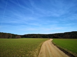
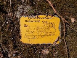
Spattendorf - Aich - Luegstetten - horse-drawn railway track
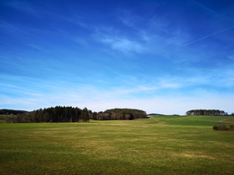
Beautiful forest and field paths offer hikers a comfortable walk to their destination. The route of the former horse-drawn railway and the Gusental nature reserve lie before you.
You can hike along the horse-drawn railway trail both to the north, towards Neumarkt, and to the south, towards Unterweitersdorf.
Starting point: Spattendorf, Grubauer Inn
Destination: Horse railway hiking trail (at the former Söser horse railway inn)
further information:
- Board possible


Accessibility / arrival
How to get there by car:
From Linz, take the A7 motorway to the "Gallneukirchen" exit
Follow the road through Gallneukirchen
After the one-way street, turn diagonally left towards "Alberndorf"
Follow the road for approx. 3 km; after the "Spattendorf" sign, there is a zebra crossing, where you will find Gasthaus Grubauer.
The start of the hiking trail is at Gasthaus Grubauer, where there are also parking facilities.
Travelling by bus:
From Linz via Gallneukirchen (you may need to change buses) to "Spattendorf Ortsmitte"
The bus stop is right next to Gasthaus Grubauer.
Most economical season
- Spring
- Summer
- Autumn
- Early winter
Please get in touch for more information.
4211 Alberndorf in der Riedmark
Phone +43 7235 7155
E-Mail tourismusverband@alberndorf.ooe.gv.at
Web www.alberndorf.at
http://www.alberndorf.at
Interactive elevation profile
Create PDF
Tour-Details
Path number: A14
Starting place: 4211 Alberndorf in der Riedmark
Destination: 4211 Alberndorf in der Riedmark
duration: 1h 4m
length: 3,9 km
Altitude difference (uphill): 36m
Altitude difference (downhill): 127m
Lowest point: 383m
Highest point: 479m
difficulty: very easy
condition: very easy
panoramic view: Individual Views
Paths covering:
Asphalt, Street, Hiking trail
powered by TOURDATA