

Rund um den Traunstein - Traunsee-Almtal Wanderspass


- Suitable for families
- culinary interesting
- Flatly
Interactive elevation profile
Create PDF
Tour-Details
Paths covering:
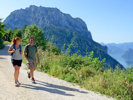
Around the Traunstein
Ramsaualm, Mair Alm (Moaralm), Hois'n Wirt
After a 1.5 hour walk you reach the Ramsaualm (perfect view). Hiking stamps available here.
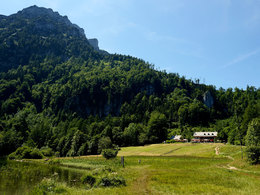
Continue in the direction of "Hohe Scharte". Up to the summit, it is a somewhat steeper climb secured with iron pins and wire ropes (only partially suitable for children and dogs).
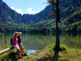
Continue through the forest into the Lainautal valley to the Mair Alm snack station (Moaralm). Hiking stamps available here.
From there continue to the Traunsee - eastern shore and back to the starting point Umkehrplatz (90 min.) or in 10 min. to the Hois'n Wirt (overnight accommodation). Hiking stamps available here.
PUBLIC - HIKING TIP: with Traunseetaxi line 10 and 30,
Traunseeschifffahrt, Grünberg cable car, electric shuttle
With the train:
With the ÖBB to Gmunden station, with the Traunseetram to Rathausplatz (boat) or Klosterplatz (Salzkammergut Shuttle Service) or with the Traunseetram from Vorchdorf to Engelhof station
Travel with the Salzkammergut Shuttle Service Line 10 "Traunstein Shuttle" from Klosterplatz or Engelhof train station to the turnaround car park or with the Traunsee boat service from Rathausplatz to Hoisn.
By car:
Gmunden Ost - (use the Park & Ride facility at Engelhof railway station)
Traunsteinstraße & Umkehrplatz (limited parking facilities, subject to charges).
Please only park in marked, designated spaces.
- Parking space: 20
Information about car parking in Gmunden: https://traunsee-almtal.salzkammergut.at/oesterreich-poi/detail/430003132/parken-parkgebuehren-in-gmunden.html
Shuttle serviceTraunstein Shuttle:
FROM 1 JANUARY - 31 DECEMBER
From 07:00 - 22:00, the Traunstein Shuttle runs route 10 every full and half hour. Please order at least 1 hour in advance with caller ID switched on by calling T +43 50 422 1691.
SONDERZEITRAUM TRAUNSTEIN-SHUTTLE (1 MAY - 31 OCTOBER). OCTOBER):
Daily 05:00 - 22:00 every half hour from the Umkehrplatz 10 A stop at the southern end of Traunsteinstraße to the stop at Klamm 10 R and back.
TRAUNSTEIN-SHUTTLE - For the journey between 05:00-07:00, please book in advance by 20:00 the evening before at the latest.
- Suitable for seniors
- Suitable for single travelers
- Suitable for families
- Suitable for friends
- Suitable for couples
- Spring
- Summer
- Autumn
Please get in touch for more information.
Toscanapark 1
4810 Gmunden
Phone +43 7612 74451
Fax machine +43 7612 71410
E-Mail info@traunsee-almtal.at
Web www.traunsee-almtal.at
Web www.wander-spass.at
http://www.wander-spass.at
karl_heinz_ruber (8) (© Foto: TVB Traunsee-Almtal/Karl-Heinz Ruber)")

Interactive elevation profile
Create PDF
Tour-Details
Paths covering: