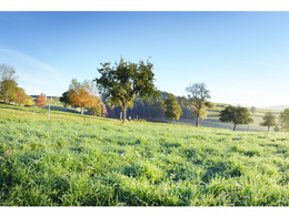
© Photo: Oberösterreich Tourismus GmbH./Robert Maybach: Enjoy the view in Upper Austria


Sterngartl Gusental MTB- Region | Sterngartl-Gusental


Interactive elevation profile
Create PDF
Tour-Details
Path number: 1 + 2
Starting place: 4202 Kirchschlag bei Linz
Destination: 4202 Kirchschlag bei Linz
duration: 15h 10m
length: 179,9 km
Altitude difference (uphill): 3.932m
Altitude difference (downhill): 3.936m
Lowest point: 276m
Highest point: 1.007m
difficulty: difficult
condition: difficult
panoramic view: Great panorama
Paths covering:
Asphalt, Gravel, Other
powered by TOURDATA
1 round of Sterngartl + 2 round of Gusental
The ultimate challenge - the combination of the Sterngartl circuit and the Gusental circuit has it all!This MTB tour through the beautiful Mühlviertel regions is ideal for individualists who like to plan a 2- or 3-day tour to explore this area.
Accommodation options are available. Entry is possible anywhere.
Starting point: Kirchschlag - obecní úřad, Gallneukirchen - rekreační středisko
Destination: Kirchschlag - obecní úřad, Gallneukirchen - rekreační středisko
details mountainbike
- Riding technique: difficult
Accessibility / arrival
Kirchschlag - municipal office,
Gallneukirchen - leisure centre
- Parking space: 15
No parking fees
E-service station / recharging station- Charging point for e-bikes (free of charge)
- Suitable for groups
- Suitable for teenagers
- Suitable for seniors
- Suitable for single travelers
- Suitable for friends
- Suitable for couples
- Spring
- Summer
- Autumn
Please get in touch for more information.
Ringstraße 77
4190 Bad Leonfelden
Phone +43 7213 20930
E-Mail office@sterngartl-gusental.at
Web www.sterngartl-gusental-leader.at
http://www.sterngartl-gusental-leader.at
Interactive elevation profile
Create PDF
Tour-Details
Path number: 1 + 2
Starting place: 4202 Kirchschlag bei Linz
Destination: 4202 Kirchschlag bei Linz
duration: 15h 10m
length: 179,9 km
Altitude difference (uphill): 3.932m
Altitude difference (downhill): 3.936m
Lowest point: 276m
Highest point: 1.007m
difficulty: difficult
condition: difficult
panoramic view: Great panorama
Paths covering:
Asphalt, Gravel, Other
powered by TOURDATA