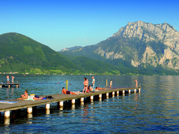
© Photo: Oberösterreich Tourismus GmbH./Robert Maybach: Enjoy the view in Upper Austria


Spaziergang Esplanade Altmünster


- Suitable for families
- Suitable for pushchairs
- Suitable for kids (all ages)
- culinary interesting
Interactive elevation profile
Create PDF
Tour-Details
Starting place: 4813 Altmünster
Destination: 4813 Altmünster
duration: 0h 10m
length: 0,8 km
Lowest point: 427m
Highest point: 431m
difficulty: very easy
condition: very easy
panoramic view: Great panorama
Paths covering:
Asphalt
powered by TOURDATA
Stroll along the esplanade directly on the lake from the sailing harbour to the fishing bay - barrier-free and suitable for prams.
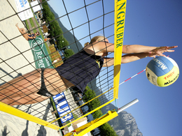
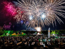
This large recreational area directly on the lake offers a large sunbathing lawn for swimmers, a campsite, sailing club, water ski and wakeboard school, beach volleyball court, tennis on the lake, stand-up paddle hire, bars and restaurant and much more. Many events take place on the lake in the area of the music pavilion. (Lake festival, sounds from the fishing boat, summer concerts, summer parties, etc.). The fishing bay and the landing stage are also in the immediate vicinity.- Suitable for kids (all ages)
- Suitable for pushchairs
- Suitable for teenagers
- Suitable for seniors
- Suitable for single travelers
- Suitable for families
- Suitable for friends
- Suitable for couples
- Suitable for children
- Spring
- Summer
- Autumn
- Early winter
Please get in touch for more information.
Esplanade
4813 Altmünster
Phone +43 7612 87181
E-Mail info@traunsee-almtal.at
Web traunsee-almtal.salzkammergut.at/or…
https://traunsee-almtal.salzkammergut.at/orte/altmuenster.html
Interactive elevation profile
Create PDF
Tour-Details
Starting place: 4813 Altmünster
Destination: 4813 Altmünster
duration: 0h 10m
length: 0,8 km
Lowest point: 427m
Highest point: 431m
difficulty: very easy
condition: very easy
panoramic view: Great panorama
Paths covering:
Asphalt
powered by TOURDATA