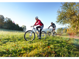
© Photo: Oberösterreich Tourismus GmbH./Robert Maybach: Enjoy the view in Upper Austria


Sterngartl Gusental MTB- Region | Sterngartl-Mitte


- Flatly
Interactive elevation profile
Create PDF
Tour-Details
Path number: B
Starting place: 4180 Zwettl an der Rodl
Destination: 4180 Zwettl an der Rodl
duration: 4h 54m
length: 59,9 km
Altitude difference (uphill): 1.165m
Altitude difference (downhill): 1.161m
Lowest point: 617m
Highest point: 1.023m
difficulty: difficult
condition: difficult
panoramic view: Great panorama
Paths covering:
Asphalt, Gravel, Other
powered by TOURDATA
Zwettl an der Rodl - Golfanlage Sterngartl - Brunnwald - Sternstein - Schenkenfelden - Reichenau - Sonnberg - Zwettl an der Rodl.
Starting from the town square in Zwettl an der Rodl (Bee hiking trail) on hilly terrain through the Sterngartl golf course, the idyllic Brunnwald, past the promising Sternstein (waiting) and through the municipal areas of Schenkenfelden (fairytale forest), Reichenau (castle ruins) and Sonnberg (generation park) back to Double Starting point: 4180 Zwettl an der Rodl, market square
Destination: 4180 Zwettl an der Rodl, market square
further information:
- Flatly
details mountainbike
- Riding technique: difficult
Parking
- Parking space: 30
- Bus parking space: 2
- Charging point for e-bikes (free of charge)
- Suitable for groups
- Suitable for teenagers
- Suitable for single travelers
- Spring
- Summer
- Autumn
Please get in touch for more information.
Ringstraße 77
4190 Bad Leonfelden
Phone +43 7213 20930
E-Mail office@sterngartl-gusental.at
Web www.sterngartl-gusental-leader.at
http://www.sterngartl-gusental-leader.at
Interactive elevation profile
Create PDF
Tour-Details
Path number: B
Starting place: 4180 Zwettl an der Rodl
Destination: 4180 Zwettl an der Rodl
duration: 4h 54m
length: 59,9 km
Altitude difference (uphill): 1.165m
Altitude difference (downhill): 1.161m
Lowest point: 617m
Highest point: 1.023m
difficulty: difficult
condition: difficult
panoramic view: Great panorama
Paths covering:
Asphalt, Gravel, Other
powered by TOURDATA