© Photo: Oberösterreich Tourismus GmbH./Robert Maybach: Enjoy the view in Upper Austria


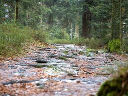
28 Sternsteinrunde


- Suitable for families
- culinary interesting
- Flatly
Interactive elevation profile
Create PDF
Tour-Details
Path number: 28
Starting place: 4190 Vorderweißenbach
Destination: 4190 Vorderweißenbach
duration: 2h 31m
length: 9,4 km
Altitude difference (uphill): 127m
Altitude difference (downhill): 125m
Lowest point: 933m
Highest point: 1.021m
difficulty: medium
condition: medium
panoramic view: Great panorama
Paths covering:
Hiking trail
powered by TOURDATA
General price information
free
- Suitable for groups
- Suitable for teenagers
- Suitable for seniors
- Suitable for single travelers
- Suitable for families
- Suitable for friends
- Suitable for couples
- Suitable for children
- Spring
- Summer
- Autumn
Please get in touch for more information.
Hauptplatz 19
4190 Bad Leonfelden
Phone +43 5 07263 - 101
E-Mail badleonfelden@muehlviertel.at
Web www.muehlviertel.at
https://www.muehlviertel.at
")
")
Interactive elevation profile
Create PDF
Tour-Details
Path number: 28
Starting place: 4190 Vorderweißenbach
Destination: 4190 Vorderweißenbach
duration: 2h 31m
length: 9,4 km
Altitude difference (uphill): 127m
Altitude difference (downhill): 125m
Lowest point: 933m
Highest point: 1.021m
difficulty: medium
condition: medium
panoramic view: Great panorama
Paths covering:
Hiking trail
powered by TOURDATA