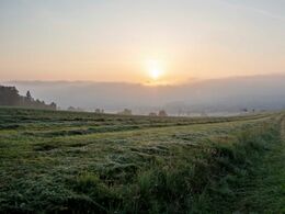
© Photo: Oberösterreich Tourismus GmbH./Robert Maybach: Enjoy the view in Upper Austria


V1 Guglwald Runde


Interactive elevation profile
Create PDF
Tour-Details
Path number: V1
Starting place: 4191 Vorderweißenbach
Destination: 4191 Vorderweißenbach
duration: 2h 15m
length: 8,0 km
Altitude difference (uphill): 159m
Altitude difference (downhill): 166m
Lowest point: 697m
Highest point: 805m
difficulty: medium
condition: medium
panoramic view: Some Views
Paths covering:
Hiking trail
powered by TOURDATA
This hike is 80% on freight routes. A little bit in between leads through a forest path. Hiking shoes are still recommended, however, as the path in the forest is partially Damp.
Marking: with the number V1Map download: V1 Guglwald Runde
Starting point: Hotel Guglwald
Destination: Hotel Guglwald
General price information
free
Most economical season
- Spring
- Summer
- Autumn
Please get in touch for more information.
Hauptplatz 19
4190 Bad Leonfelden
Phone +43 5 07263 - 101
E-Mail badleonfelden@muehlviertel.at
Web www.muehlviertel.at
https://www.muehlviertel.at
")
")
Interactive elevation profile
Create PDF
Tour-Details
Path number: V1
Starting place: 4191 Vorderweißenbach
Destination: 4191 Vorderweißenbach
duration: 2h 15m
length: 8,0 km
Altitude difference (uphill): 159m
Altitude difference (downhill): 166m
Lowest point: 697m
Highest point: 805m
difficulty: medium
condition: medium
panoramic view: Some Views
Paths covering:
Hiking trail
powered by TOURDATA