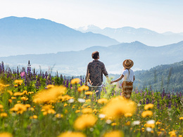
© Photo: Oberösterreich Tourismus GmbH./Robert Maybach: Enjoy the view in Upper Austria


Rundtour zu Radstattkapelle und Hochalm am Mondseeberg


- Flatly
Interactive elevation profile
Create PDF
Tour-Details
Path number: 2, 5, 3
Starting place: 5310 Mondsee am Mondsee
Destination: 5310 Mondsee am Mondsee
duration: 4h 43m
length: 13,5 km
Altitude difference (uphill): 551m
Altitude difference (downhill): 536m
Lowest point: 660m
Highest point: 1.013m
difficulty: easy
condition: medium
panoramic view: Individual Views
Paths covering:
Asphalt, Gravel, Hiking trail, Other
powered by TOURDATA
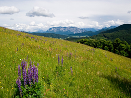
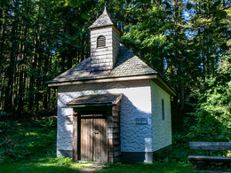
Beautiful circular tour on the Mondseeberg to the Radstatt Chapel in the forest and to the former Hochalm with wonderful views.
Parking
- Parking space: 7
- Suitable for groups
- Suitable for teenagers
- Suitable for seniors
- Suitable for single travelers
- Suitable for friends
- Suitable for couples
- Suitable for children
- Spring
- Summer
- Autumn
Please get in touch for more information.
Dr. Franz Müller Str. 3
5310 Mondsee am Mondsee
Phone +43 6232 2270
Fax machine +43 6232 2270 - 22
E-Mail info@mondsee.at
Web mondsee.salzkammergut.at/
https://mondsee.salzkammergut.at/
Interactive elevation profile
Create PDF
Tour-Details
Path number: 2, 5, 3
Starting place: 5310 Mondsee am Mondsee
Destination: 5310 Mondsee am Mondsee
duration: 4h 43m
length: 13,5 km
Altitude difference (uphill): 551m
Altitude difference (downhill): 536m
Lowest point: 660m
Highest point: 1.013m
difficulty: easy
condition: medium
panoramic view: Individual Views
Paths covering:
Asphalt, Gravel, Hiking trail, Other
powered by TOURDATA