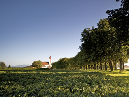
© Photo: Oberösterreich Tourismus GmbH./Robert Maybach: Enjoy the view in Upper Austria


Paracelsus Runde by Runnersfun


Interactive elevation profile
Create PDF
Tour-Details
Starting place: 4654 Bad Wimsbach-Neydharting
Destination: 4654 Bad Wimsbach-Neydharting
duration: 1h 18m
length: 19,2 km
Altitude difference (uphill): 95m
Altitude difference (downhill): 99m
Lowest point: 376m
Highest point: 451m
difficulty: medium
condition: medium
panoramic view: Some Views
Paths covering:
Asphalt
powered by TOURDATA
Moorbad Neydharting exercise arena - Innerroh loop - marked blue
The Innerroh loop begins on public roads with a slight ascent at the Neydharting moor bath and leads past agricultural land to Kößlwang. Past the Kößlwangbach stream, slightly uphill via the municipality of Giering to Penning. The route continues downhill through the natural landscape via Bergham past the Maria am Weg chapel in Bachloh to the starting point. Good cycling and catering equipment is advisable! Most economical season
- Spring
- Summer
- Autumn
- Early winter
- Deep winter
Please get in touch for more information.

Krottenseestraße 45
4810 Gmunden
Phone +43 7612 20822
E-Mail office@runnersfun.com
Web www.runnersfun.com/
http://www.runnersfun.com/
Interactive elevation profile
Create PDF
Tour-Details
Starting place: 4654 Bad Wimsbach-Neydharting
Destination: 4654 Bad Wimsbach-Neydharting
duration: 1h 18m
length: 19,2 km
Altitude difference (uphill): 95m
Altitude difference (downhill): 99m
Lowest point: 376m
Highest point: 451m
difficulty: medium
condition: medium
panoramic view: Some Views
Paths covering:
Asphalt
powered by TOURDATA