© Photo: Oberösterreich Tourismus GmbH./Robert Maybach: Enjoy the view in Upper Austria


Saurüssel-Runde


- Flatly
Interactive elevation profile
Create PDF
Tour-Details
Path number: S464
Starting place: 4893 Zell am Moos am Irrsee
Destination: 4893 Zell am Moos am Irrsee
duration: 2h 41m
length: 31,9 km
Altitude difference (uphill): 700m
Altitude difference (downhill): 699m
Lowest point: 554m
Highest point: 844m
difficulty: easy
condition: medium
panoramic view: Individual Views
Paths covering:
Asphalt, Gravel
powered by TOURDATA
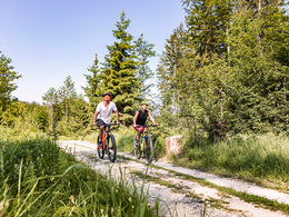
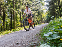
This beautiful mountain bike tour takes you from the centre of Zell am Moos am Irrsee to the so-called Saurüssel.
further information:
- Flatly
- Board possible
details mountainbike
- Riding technique: easy
Parking
- Parking space: 10
Most economical season
- Spring
- Summer
- Autumn
Please get in touch for more information.
Dr. Franz Müller Str. 3
5310 Mondsee am Mondsee
Phone +43 6232 2270
Fax machine +43 6232 2270 - 22
E-Mail info@mondsee.at
Web mondsee.salzkammergut.at/
https://mondsee.salzkammergut.at/
Interactive elevation profile
Create PDF
Tour-Details
Path number: S464
Starting place: 4893 Zell am Moos am Irrsee
Destination: 4893 Zell am Moos am Irrsee
duration: 2h 41m
length: 31,9 km
Altitude difference (uphill): 700m
Altitude difference (downhill): 699m
Lowest point: 554m
Highest point: 844m
difficulty: easy
condition: medium
panoramic view: Individual Views
Paths covering:
Asphalt, Gravel
powered by TOURDATA