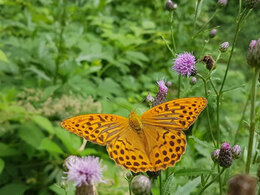
© Photo: Oberösterreich Tourismus GmbH./Robert Maybach: Enjoy the view in Upper Austria


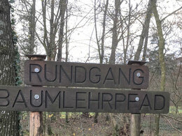
Vom Wald lernen. Baumlehrpfad Kronstorf.


- All weather
- Suitable for families
Interactive elevation profile
Create PDF
Tour-Details
Starting place: 4484 Kronstorf
Destination: 4484 Kronstorf
duration: 0h 45m
length: 3,1 km
Altitude difference (uphill): 11m
Altitude difference (downhill): 12m
Lowest point: 276m
Highest point: 294m
difficulty: very easy
condition: very easy
panoramic view: No view
Paths covering:
Hiking trail
powered by TOURDATA
The Winklingerwald forest, a natural jewel and popular recreational area, is located in the municipality of Kronstorf close to the River Enns.
An ideal setting for the three-kilometre-long educational tree trail, which is part of the "Kirchschläger hiking trail" set up by the Kronstorf Friends of Nature. At 47 stations, walkers learn interesting facts about local trees and shrubs in the "Winklinger Holz", their mythology, the customs associated with them and their use in folk medicine. Places of power, which have been sounded out by a diviner, invite you to linger in between.
A tip:
The tree nature trail is particularly impressive during the fascinating blooming of the snow lilies.
- All weather
- Suitable for groups
- Suitable for children
- Spring
- Summer
- Autumn
Please get in touch for more information.
Winkling 3
4484 Kronstorf
Phone +43 676 4515645
E-Mail gemeinde@kronstorf.ooe.gv.at
Web www.kronstorf.at
https://www.kronstorf.at
Interactive elevation profile
Create PDF
Tour-Details
Starting place: 4484 Kronstorf
Destination: 4484 Kronstorf
duration: 0h 45m
length: 3,1 km
Altitude difference (uphill): 11m
Altitude difference (downhill): 12m
Lowest point: 276m
Highest point: 294m
difficulty: very easy
condition: very easy
panoramic view: No view
Paths covering:
Hiking trail
powered by TOURDATA