© Photo: Oberösterreich Tourismus GmbH./Robert Maybach: Enjoy the view in Upper Austria


The "mighty vista" panoramic hike


- Flatly
Interactive elevation profile
Create PDF
Tour-Details
Path number: 855 + 3
Starting place: 5340 St. Gilgen
Destination: 5340 St. Gilgen
duration: 3h 12m
length: 8,5 km
Altitude difference (uphill): 479m
Altitude difference (downhill): 480m
Lowest point: 539m
Highest point: 823m
difficulty: medium
condition: medium
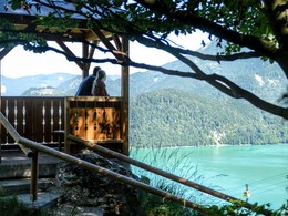
panoramic view: Great panorama
Paths covering:
Asphalt, Gravel, Hiking trail
powered by TOURDATA
Start: Mozartplatz square St. Gilgen
Pfarrgasse lane - cross the main road - bear to the Breitfeldweg path - signposted trail No. 855, join trail No. 3 to the Gamswandalm pastures - past the "Gschmahplatzl Margarethenhöhe" (optional extra loop to Weißwand possible from here) - Gamswandalm - Franzosenschanze - walk the lakeside path (trail No. 12) to the hamlet of Lueg and continue on the lake promenade to Mozartplatz square.
Pfarrgasse lane - cross the main road - bear to the Breitfeldweg path - signposted trail No. 855, join trail No. 3 to the Gamswandalm pastures - past the "Gschmahplatzl Margarethenhöhe" (optional extra loop to Weißwand possible from here) - Gamswandalm - Franzosenschanze - walk the lakeside path (trail No. 12) to the hamlet of Lueg and continue on the lake promenade to Mozartplatz square.
Starting point: Mozartplatz square St. Gilgen
Destination: Mozartplatz square St. Gilgen
further information:
- Flatly
Most economical season
- Spring
- Summer
- Autumn
Please get in touch for more information.
Au 140
5360 St. Wolfgang im Salzkammergut
Phone +43 6138 8003
E-Mail info@wolfgangsee.at
Web www.wolfgangsee.at
http://www.wolfgangsee.at
Interactive elevation profile
Create PDF
Tour-Details
Path number: 855 + 3
Starting place: 5340 St. Gilgen
Destination: 5340 St. Gilgen
duration: 3h 12m
length: 8,5 km
Altitude difference (uphill): 479m
Altitude difference (downhill): 480m
Lowest point: 539m
Highest point: 823m
difficulty: medium
condition: medium
panoramic view: Great panorama
Paths covering:
Asphalt, Gravel, Hiking trail
powered by TOURDATA