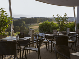
© Photo: Oberösterreich Tourismus GmbH./Robert Maybach: Enjoy the view in Upper Austria
G8 Alberndorf-Unterweitersdorf Runde


- Flatly
Interactive elevation profile
Create PDF
Tour-Details
Path number: G8
Starting place: 4211 Alberndorf in der Riedmark
Destination: 4211 Alberndorf in der Riedmark
duration: 1h 21m
length: 19,1 km
Altitude difference (uphill): 343m
Altitude difference (downhill): 339m
Lowest point: 352m
Highest point: 595m
difficulty: medium
condition: easy
panoramic view: Some Views
Paths covering:
Gravel, Street, unfixed
powered by TOURDATA
Cycle route G8 from Alberndorf via the Peter Affenzeller whisky distillery and café lounge to Unterweitersdorf and back again via Spattendorf
Mostly tarmac, some gravel/field paths
No signposting!
Friedhof Alberndorf
Friedhof Alberndorf
Accessibility / arrival
The tour starts in the centre of Alberndorf
Bus stop: "Alberndorf Ortsmitte"
Free parking: behind the municipal office (incl. charging station for e-cars and e-bikes) or at the cemetery
- Charging point for electric cars (fees apply)
- Charging point for e-bikes (free of charge)
- Suitable for groups
- Suitable for teenagers
- Suitable for seniors
- Suitable for single travelers
- Suitable for friends
- Suitable for couples
- Spring
- Summer
- Autumn
Please get in touch for more information.
Kalchgruberstraße 2
4211 Alberndorf in der Riedmark
Phone +43 7235 7155
E-Mail gemeinde@alberndorf.ooe.gv.at
Interactive elevation profile
Create PDF
Tour-Details
Path number: G8
Starting place: 4211 Alberndorf in der Riedmark
Destination: 4211 Alberndorf in der Riedmark
duration: 1h 21m
length: 19,1 km
Altitude difference (uphill): 343m
Altitude difference (downhill): 339m
Lowest point: 352m
Highest point: 595m
difficulty: medium
condition: easy
panoramic view: Some Views
Paths covering:
Gravel, Street, unfixed
powered by TOURDATA


