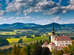
© Photo: Oberösterreich Tourismus GmbH./Robert Maybach: Enjoy the view in Upper Austria


K32 Andreas-Reischek-Weg


- Flatly
Interactive elevation profile
Create PDF
Tour-Details
Path number: K32
Starting place: 4292 Kefermarkt
Destination: 4292 Kefermarkt
duration: 0h 36m
length: 1,8 km
Altitude difference (uphill): 72m
Altitude difference (downhill): 72m
Lowest point: 502m
Highest point: 575m
difficulty: very easy
condition: very easy
panoramic view: Individual Views
Paths covering:
Asphalt, Hiking trail, Other
powered by TOURDATA
Short loop above Kefermarkt with a wonderful view.
We set off uphill, passing the imposing church on the way. At the next junction, turn left and continue uphill. At the next junction to the left, we turn off into a new housing estate. Up here you have a wonderful view over the village.
A lovely bench invites you to linger. Now it's downhill through the forest and back to the starting point.
Starting point: Kefermarkt marketplace
Destination: Kefermarkt marketplace
further information:
- Flatly
- Experience of nature
Most economical season
- Spring
- Summer
- Autumn
Please get in touch for more information.
Oberer Markt 15
4292 Kefermarkt
Phone +43 7947 5910 - 0
E-Mail gemeinde@kefermarkt.ooe.gv.at
Web www.kefermarkt.ooe.gv.at
Web www.muehlviertel-urlaub.at/wandern
https://www.kefermarkt.ooe.gv.at
https://www.muehlviertel-urlaub.at/wandern
https://www.muehlviertel-urlaub.at/wandern
Interactive elevation profile
Create PDF
Tour-Details
Path number: K32
Starting place: 4292 Kefermarkt
Destination: 4292 Kefermarkt
duration: 0h 36m
length: 1,8 km
Altitude difference (uphill): 72m
Altitude difference (downhill): 72m
Lowest point: 502m
Highest point: 575m
difficulty: very easy
condition: very easy
panoramic view: Individual Views
Paths covering:
Asphalt, Hiking trail, Other
powered by TOURDATA