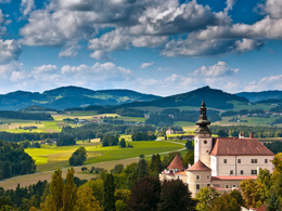
© Photo: Oberösterreich Tourismus GmbH./Robert Maybach: Enjoy the view in Upper Austria


K39 Grüblweg


- Flatly
Interactive elevation profile
Create PDF
Tour-Details
Path number: K39
Starting place: 4292 Kefermarkt
Destination: 4292 Kefermarkt
duration: 2h 29m
length: 8,8 km
Altitude difference (uphill): 166m
Altitude difference (downhill): 169m
Lowest point: 466m
Highest point: 551m
difficulty: easy
condition: easy
panoramic view: Individual Views
Paths covering:
Asphalt, Hiking trail, Other
powered by TOURDATA
We walk downhill from the starting point, cross the railway and keep left at the Kefermarkt outdoor pool;
We walk past the last houses, go briefly downhill and cross the Lest stream. We now walk uphill, past a small settlement and keep right into the forest. We go downhill, cross the Lest stream again and then uphill again. We reach a district road, follow it for approx. 300m to the left and after walking through a short forest we turn right.Here you have the option of following the road for a further 400m and taking a break at Gasthaus Mader.
After turning right, we walk along the settlement road, downhill, then uphill, after a while we cross the district road again and slowly approach the starting point again along an inconspicuous meadow path.
We leave a few more farmhouses behind us and reach the first houses of Kefermarkt again. We walk the last few metres along the same route back to the starting point;
Starting point: Kefermarkt marketplace
Destination: Kefermarkt marketplace
further information:
- Flatly
Most economical season
- Spring
- Summer
- Autumn
Please get in touch for more information.
Oberer Markt 15
4292 Kefermarkt
Phone +43 7947 5910 - 0
E-Mail gemeinde@kefermarkt.ooe.gv.at
Web www.kefermarkt.ooe.gv.at/
Web www.muehlviertel-urlaub.at/wandern
https://www.kefermarkt.ooe.gv.at/
https://www.muehlviertel-urlaub.at/wandern
https://www.muehlviertel-urlaub.at/wandern
Interactive elevation profile
Create PDF
Tour-Details
Path number: K39
Starting place: 4292 Kefermarkt
Destination: 4292 Kefermarkt
duration: 2h 29m
length: 8,8 km
Altitude difference (uphill): 166m
Altitude difference (downhill): 169m
Lowest point: 466m
Highest point: 551m
difficulty: easy
condition: easy
panoramic view: Individual Views
Paths covering:
Asphalt, Hiking trail, Other
powered by TOURDATA